
TRUE NORTH GEOPHYSICS
LAND BASED GEOPHYSICS

SEISMIC METHODS
We offer a full suite of seismic testing methods to meet any client needs, which include the following:
-
Seismic Refraction - for depth to bedrock, soil and bedrock seismic velocities, rippability of rock, sedimentary layering. ASTM D5777.
-
Seismic Reflection - for depth to bedrock, mapping different bedrock layers. ASTM D7128.
-
Multichannel Analysis of Surface Waves (MASW) - for depth to bedrock, void detection, shear wave velocity of soil and rock, seismic site classification (Vs30). NBCC 2020.
-
Vertical Seismic Profiling (VSP) - for soil and bedrock velocities and engineering properties (Elastic Modulus, Shear Modulus, Young's Modulus), seismic site classification (Vs30). NBCC 2020.
-
Seismic Crosshole Testing and Tomography - for soil and bedrock velocities and engineering properties (Elastic Modulus, Shear Modulus, Young's Modulus, material damping), seismic site classification (Vs30) and profiling of material between boreholes, including voids. NBCC 2020.
-
Parallel Seismic Testing - to determine depth of deep foundation walls, piles, and caissons. ASTM D8381.

ELECTRICAL RESISTIVITY
We offer a full suite of electrical resistivity testing methods to meet any client needs, which include the following:
-
Electrical Resistivity Tomography (ERT/ERI) - can be performed using both 2D and 3D arrays. Includes Wenner, Schlumberger, and Dipole testing. ASTM G57-20. ERT/ERI testing can be carried out for:
-
Mapping of subsurface layers and bedrock depth
-
Detection of voids in the subsurface
-
Mapping of contaminant plumes
-
Aggregate mapping and volume estimation
-
Mapping of groundwater seepage through dams/dykes/levees
-
-
Vertical Electrical Sounding (VES) - VES surveys are used primarily to support electrical grounding design for buildings, dams or other structures that require electrical grounding grids
-
Fall of Potential Surveys - these electrical surveys are completed to test the performance of existing grounding systems for buildings.
-
Liner Leak Evaluations - these survey can be carried out over lined ponds or landfill cells to identify the location of a leak present. These methods are often used during the construction phase of new landfill cells or for existing lined ponds/cells when leaks are suspected. The methods are capable of identifying very small leaks in ponds covered by sand, rock or water. ASTM D7007.

GROUND PENETRATING RADAR
We offer ground penetrating radar (GPR) surveys for the following purposes:
-
Map buried utilities and pipelines
-
Locate buried metallic objects present on a site
-
Detection of graves and features of archaeological importance
-
Mapping depth to sedimentary layers and shallow bedrock
-
Pavement and concrete thickness mapping of pavement structures for road rehabilitation
-
Mapping of rebar spacing and depth within concrete structures for construction verification purposes
-
Locating voids within and beneath concrete structures

ELECTROMAGNETIC METHODS
We offer electromagnetic testing using frequency and time domain EM methods. These methods can be used to:
-
Map buried utilities and pipelines
-
Locate buried metallic objects present on a site
-
Map extents of former/abandoned landfill sites
-
Map extents of a leachate plume or contaminated groundwater plume
-
Find metallic debris in fill materials that can pose risk to a construction project

MAGNETIC METHODS
We offer magnetic testing for the following:
-
Mapping of buried metallic debris present on a site
-
Mapping of features of archaeological importance at a site
-
Determining the extent of former/abandoned landfill sites
-
Location of abandoned wells such as oil field wells
-
Mapping of geological structure within bedrock

MICROGRAVITY
We offer microgravity testing for sites. Microgravity surveying can be used for:
-
Locating and mapping underground voids, such as tunnels, mine working, natural caves and sinkholes
-
Mapping buried valleys
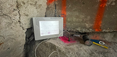
NON DESTRUCTIVE TESTING
We offer non-destructive testing of caissons and piles to determine their length and identify defects within them. We also offer investigation of concrete slabs and engineered structures. Methods we offer include:
-
Pile Integrity (PIT) Testing
-
Thermal Conductivity Testing of Soils and Rock
-
Ground Penetrating Radar (GPR) to investigate concrete structures, rebar spacing and depth, and anomalies including voids within and beneath the concrete or pavement structures
-
Impact Echo Testing to investigate concrete thickness, strength, and defects within the concrete